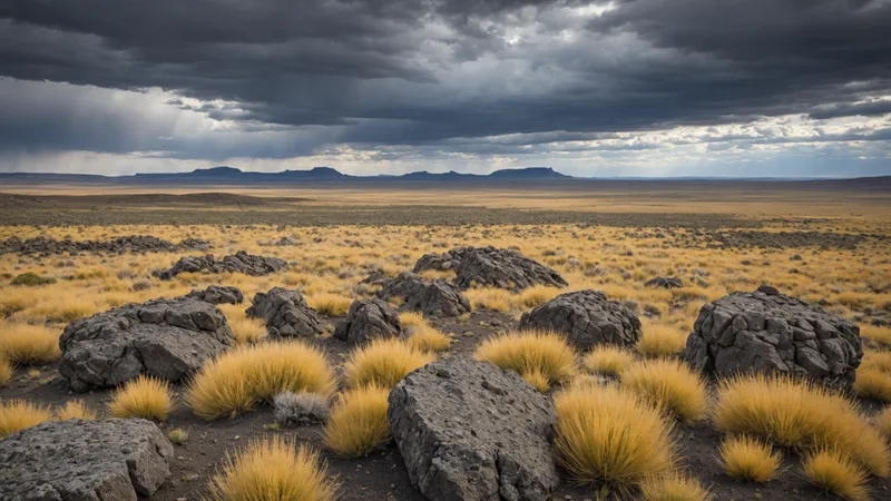
The Columbia Plateau shrub-steppe is a very different environment from the riparian and wetland sites that anchor most of our current enrollment portfolio. No running water, no emergent vegetation, no amphibian chorus at dawn. eDNA in this system comes primarily from soil and aerial deposition rather than the water column, the target species assemblage is arid-land adapted, and the acoustic profile is characterized more by dawn songbird activity than by the multi-taxa chorus of wetter ecosystems. When we enrolled our first Columbia Plateau site — a 280-hectare sage-bitterbrush restoration block in the northern Columbia Basin — we expected the methodology to perform differently. We did not fully anticipate what the detection record would show.
Site Background and Enrollment Context
The site occupies a section of the Columbia Plateau basalt formation at approximately 700 meters elevation, managed by a private landowner who had been undertaking active cheatgrass (Bromus tectorum) suppression and native bunchgrass restoration since 2021. Prior to our assessment, the primary vegetation cover was a mix of recovering big sagebrush (Artemisia tridentata), antelope bitterbrush (Purshia tridentata), and remnant native bunchgrasses — Idaho fescue (Festuca idahoensis) and bluebunch wheatgrass (Pseudoroegneria spicata) — with scattered zones of persistent cheatgrass pressure in disturbed areas.
The site had no prior formal biodiversity assessment. The landowner's management history records documented regular bird observations (mostly raptors and migratory passerines) and occasional sightings of pronghorn and mule deer, but no systematic survey of reptile, small mammal, or invertebrate communities. Our enrollment assessment was the first structured biological monitoring the site had received.
Adapting eDNA Protocols for Dryland Systems
Soil eDNA collection in shrub-steppe requires a fundamentally different field approach from water-column sampling. We used a composite soil core protocol: at each of seven sampling stations distributed across the site's major habitat units (dense sagebrush, open bunchgrass, bitterbrush transition, and degraded cheatgrass recovery zone), we collected five 2-cm diameter cores to 5 cm depth within a 10-meter radius, homogenized the cores in a single sterile sample bag, and subsampled for DNA extraction. Cores were taken in the early morning to minimize UV-driven DNA degradation on soil surfaces.
Field blanks used sterile sand rather than water as the matrix, processed identically to samples. Soil extraction used a modified PowerSoil DNA extraction kit with extended bead beating, which improves cell lysis in the organic-poor, clay-mineral-rich Columbia Plateau soils compared to the standard protocol optimized for wetter, organic-rich soils.
Acoustic monitoring used a modified deployment period: the Columbia Plateau has far lower acoustic activity in summer compared to our coastal riparian sites, so we extended the recording period to 21 days and concentrated analysis on the dawn chorus window (approximately 30 minutes before to 60 minutes after sunrise), when shrub-steppe songbird and lizard activity is highest.
The Three Unexpected Detections
The eDNA detection record from the April 2026 campaign included 28 vertebrate ASVs assignable to confirmed taxa. The majority were expected: lizard genera consistent with the sage-steppe community, small mammal detections (sagebrush vole, deer mouse, black-tailed jackrabbit), and passerine eDNA from the dawn chorus species visible in the acoustic record. Three detections were not anticipated based on the management history or regional habitat mapping:
- Pygmy short-horned lizard (Phrynosoma douglasii) — IUCN Near Threatened, Oregon Department of Fish and Wildlife Species of Concern. P. douglasii populations have declined substantially across the Columbia Plateau due to loss of native ant prey associated with bunchgrass community degradation. Their detection at this site — which has been actively restoring native bunchgrass — is ecologically interpretable as a positive signal: recovering bunchgrass habitat supports the harvester ant colonies on which the species depends. This is the detection that carries the IUCN Near Threatened designation referenced in our campaign summary.
- Long-billed curlew (Numenius americanus) — detected by soil eDNA (consistent with ground-nesting behavior) and confirmed by acoustic detection in the April campaign. Long-billed curlews are a grassland breeding species that has undergone range contraction with shrub-steppe fragmentation; their presence as a breeding-season detection (not just migratory flyover) is a meaningful indicator of sufficient open-ground habitat area and sagebrush community structure for nesting.
- Sagebrush lizard (Sceloporus graciosus) — while not rare, this was not present in prior management records and its detection at four of seven stations at high occupancy probability indicates a well-established resident population consistent with a recovering bunchgrass-sagebrush mosaic. Combined with the P. douglasii detection, the lizard community profile suggests the native ant community is recovering — since both species depend on ant prey, their co-occurrence is a biotic interaction signal not available from vegetation surveys alone.
Detecting Phrynosoma douglasii through soil eDNA at a site with no prior herpetological survey record is precisely the kind of finding that would never appear in a vegetation-based habitat condition assessment. It is also the finding most relevant to a credit buyer documenting conservation value.
Implications for Credit Valuation
The P. douglasii detection materially changes the credit valuation trajectory for this site. Under our BHI scoring framework, the presence of an IUCN Near Threatened species at confirmed occupancy triggers a conservation significance multiplier on the species richness component. The preliminary BHI baseline score for this site is 68 / Provisional — one point below the Verified tier threshold — but the P. douglasii detection will anchor a conversation with our independent reviewer about whether the occupancy model evidence is sufficient to apply the Near Threatened multiplier in the current scoring cycle, which could push the score above 70.
More broadly, the detection illustrates the asymmetric discovery upside in measurement-based credit verification. A vegetation survey of this site would have scored it as recovering sage-steppe in intermediate condition — a reasonable but undifferentiated assessment that would not distinguish it from hundreds of other plateau restoration sites. The eDNA record identifies a specific conservation-significant species that uses the site as habitat and whose presence reflects the restoration trajectory. That is information that changes the ecological story and, consequently, the financial story for the credit.
Next Steps and Re-Sampling Protocol
Given the P. douglasii detection, we have scheduled a targeted re-sampling campaign for August 2026 focused on confirming population establishment rather than single-event presence. P. douglasii eDNA detection in spring corresponds to emergence from winter brumation; the August campaign will assess summer-active density and, in combination with the spring data, provide the temporal replicate structure needed for a defensible occupancy model estimate.
We will also expand the acoustic monitoring to include nighttime cycles in the August campaign, targeting potential bat detection using ultrasonic recording. Bat communities in Columbia Plateau shrub-steppe include several foraging species (notably pallid bat, Antrozous pallidus, and big brown bat, Eptesicus fuscus) whose detection would round out the insectivore guild profile and contribute to the habitat completeness component of the BHI score. These results will be reported in a follow-up field report when available.